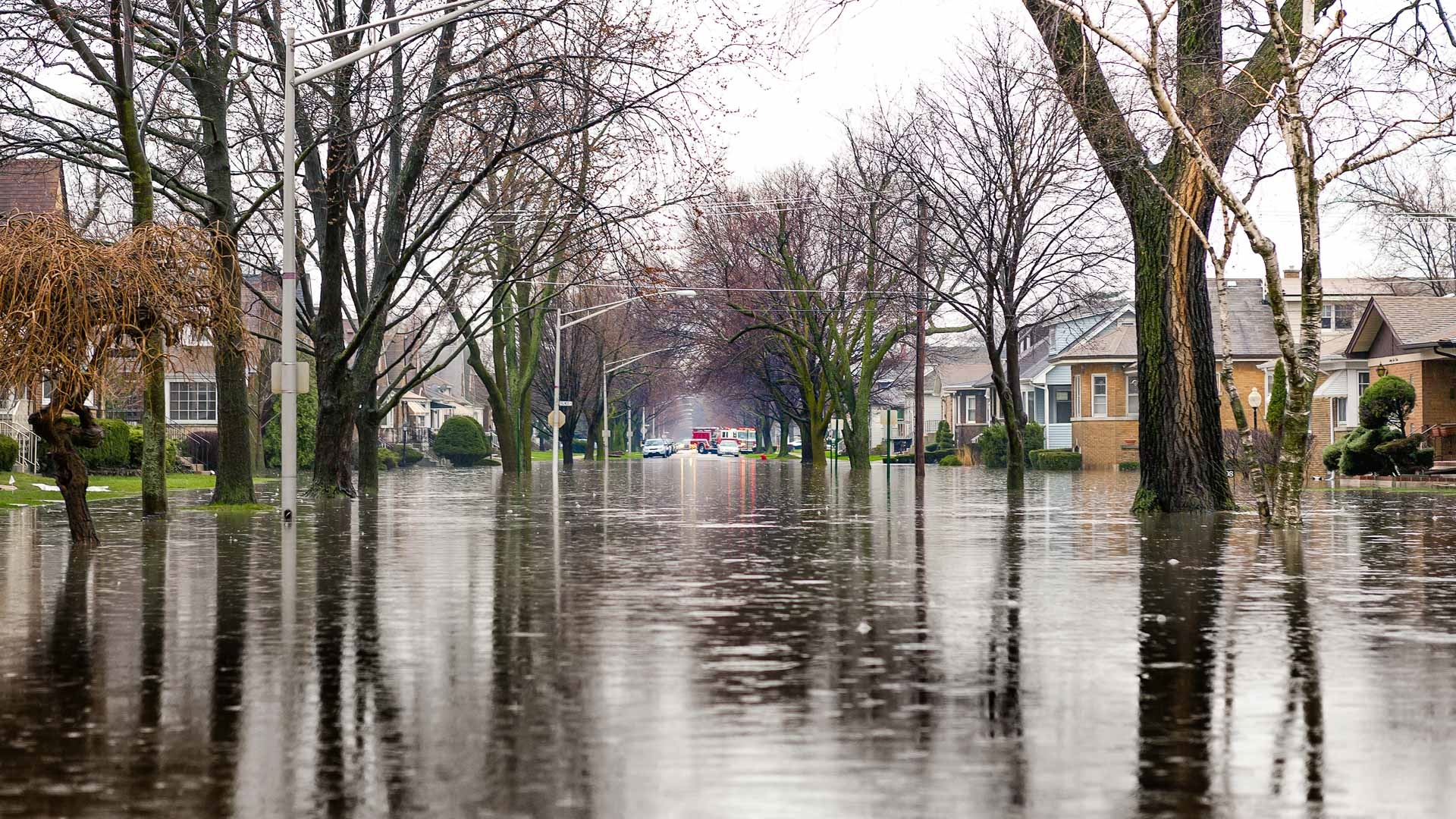
Studying flood hazards and impacts in Jamaica.
The Science
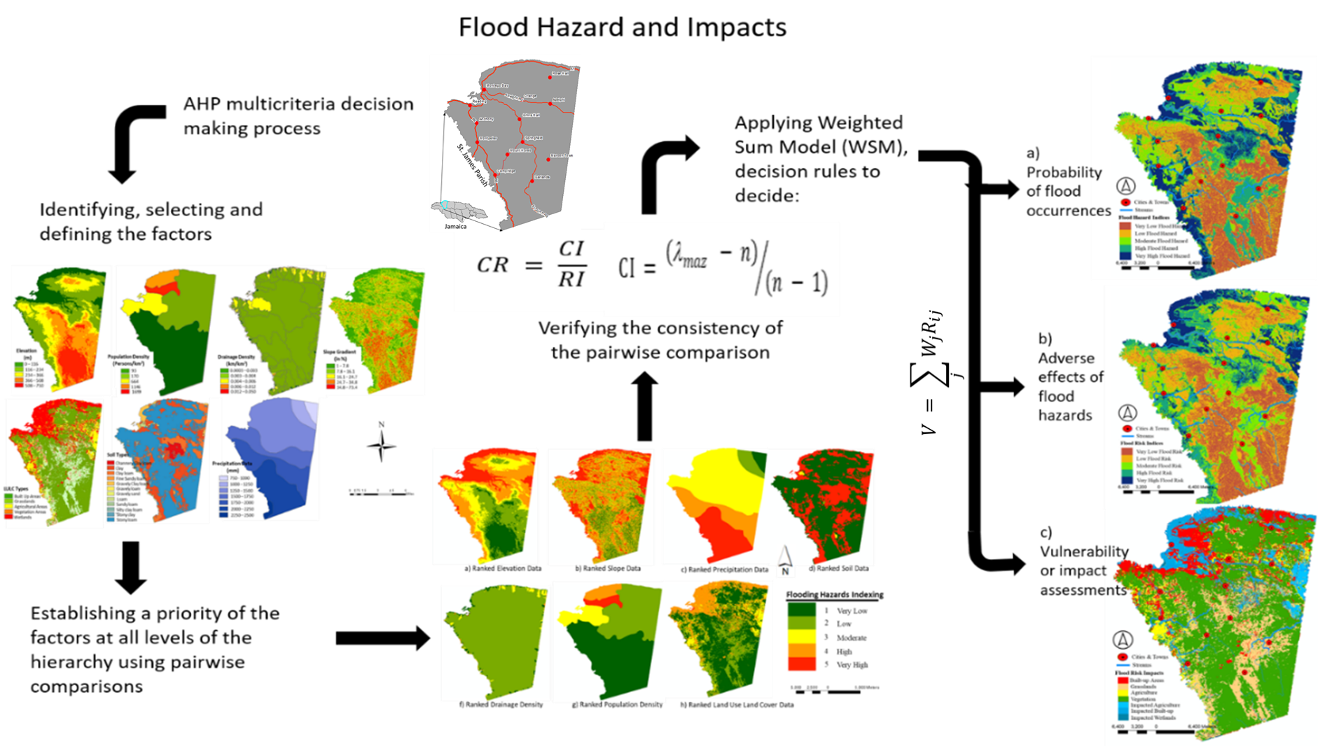
By assessing the likelihood of flood hazard occurrences, exposure, and vulnerability, a team of researchers shed light on the order of importance of factors affecting flood hazard occurrence probability. The team also assessed vulnerability and risk to properties and lives from the exposure. For Caribbean islands such as Jamaica, climate change effects characterized by sea level rise, heavy precipitations, intense storm surges from tropical cyclones (i.e., hurricanes), mountainous topographies, growing population, land development, and increasing impervious surfaces expose low-lying settlement areas to a heightened likelihood of frequent flood hazards.
The Impact
Floods become hazardous when areas with the highest probability of occurrence coincide with densely populated regions, public infrastructures, agricultural areas, and lands reserved for ecological significance. Hazardous impacts can be mitigated through public education and advocacy for adequate environmental responsibilities and responses to flood preparedness, prevention, and control; channeling or re-engineering the drainage or gully infrastructure; urban planning for green cities; and arresting land development (i.e., building houses and commercial buildings) along the flood-prone areas.
Summary
Researchers assessed areas with a 1% chance of flood hazard and risk (a 100-year flood) in the flood-stricken port city of Montego Bay. Researchers deployed a relatively simple but robust method involving the geographic information systems–based analytical hierarchy process (AHP) that enlisted risk factors, prioritizing (ranking), weight allocation, and modeling. Accordingly, 36% of the study area experiences a high or very high probability of flood occurrences, out of which 25% is subjected to high or very high vulnerability risks. Although significant, the study has limitations. The AHP approach is a pragmatic choice due to its lesser data requirement and simplicity; this study used some published secondary data and high-resolution imagery for ground truthing. Future works using advanced modeling approaches and calibrations with ground truthing may improve the results.
PRINCIPAL INVESTIGATOR
Tekleab Gala
Chicago State University
[email protected]
PROGRAM MANAGER
Sally McFarlane
U.S. Department of Energy,
Biological and Environmental Research (SC-33)
Urban Integrated Field Laboratories
[email protected]
Funding
This material is based upon work supported by the Biological and Environmental Research program within the U.S. Department of Energy’s Office of Science under Award Number DE-SC0023298.
References
McKenzie, R., and T. Gala. “Likelihoods of Flood Hazards and Risks Using GIS-Based Analytical Hierarchy Process (AHP).” Academic Journal of Environment & Earth Science 5 (9), 8–20 (2023). https://doi.org/10.25236/AJEE.2023.050902.